
INTRODUCING METRO SOUTH
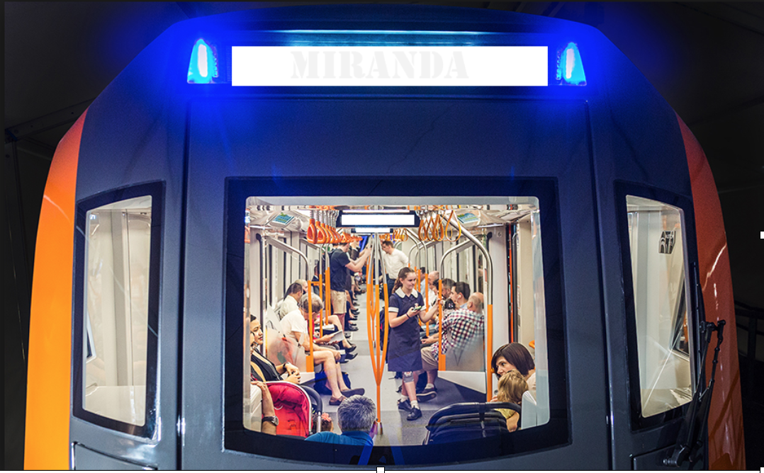
SYDENHAM to MIRANDA
Introduction
No sane government would cannibalise two existing heavy rail lines with high quality double deck trains and convert them to a single deck metro with less than half the number of seats. This is however, what is happening in Sydney with the Epping to Chatswood Line and the Sydenham to Bankstown Line being consumed into the Sydney Metro.
The NSW Government is not doing this to improve public transport and get commuters out of their cars and on to public transport, the Government is doing this to provide developers the opportunity to over develop areas of Sydney, thereby destroying communities and destroying heritage.
Why Create the Metro South?
The NSW Government doesn’t want commuters to leave their cars in the garage and catch trains instead – this would destroy the business model of the Toll Road Operators, who donate significant sums of money to political parties. The whole raison d’être for the Metro North West is to provide transport for families who will be crowded into high-rise developments along its route, providing huge profits for developers and causing the destruction of communities in suburbs such as Waterloo, Marrickville, Campsie, Belmore, Lakemba and Bankstown.
The Metro North West from Cudgegong Road to Chatswood will most probably be in operation prior to the 2019 election. EcoTransit has previously put forward a plan to divert the Metro south from Epping to Blakehurst, interchanging with all of the radial heavy rail lines leading to the CBD. Even if the Epping to Chatswood Line has been subsumed into the Metro, the diversion of the Metro to Blakehurst would still be possible; leaving the line from Epping to Chatswood to be returned to the heavy rail network.
Prior to the 2019 Election the NSW Government will be endeavouring to have contracts signed and tunnel boring machines (TBM) in the ground, for the second section of the Metro from Chatswood to Sydenham. They will also be trying to have contacts let and work started on the third stage from Sydenham to Bankstown. If the second stage has been progressed to a point where it is not possible to vary the contracts, it will be inevitable that it will be built at least as far as Sydenham.
What is the Metro South?
To save the existing Sydenham – Bankstown Line and the communities that stretch out along it, the current Sydenham-Bankstown Metro proposal should be diverted from Sydenham on a route that currently does not have a rail service. This would significantly expand Sydney’s rail network, and not just replace one service with another inferior service.
EcoTransit has identified an alternative route that would not only provide a rail service to an area that currently has none but would also be an alternative to the F6 tollway to the Sutherland Shire. The route would create a new Metro South through Sans Souci, across the Georges River to a terminus at Miranda, where there would be an interchange with the Cronulla Line.
This Metro South rail alternative to the F6 would be cheaper to construct than the Tollway and would have the added benefits that it would have a higher capacity per hour and provide a faster rail service to the CBD than is currently possible via Sutherland and Como.
The accompanying maps details the most probable route (A) with two possible alternative routes (B) and (C). The final route would naturally depend on a geotechnical report to ascertain the feasibility of route (A) and routes (B) and (C) and combinations of the three routes.
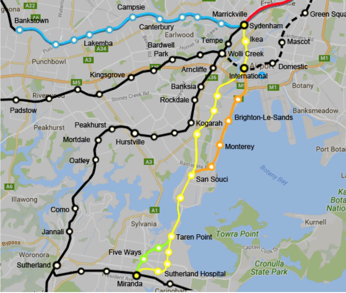
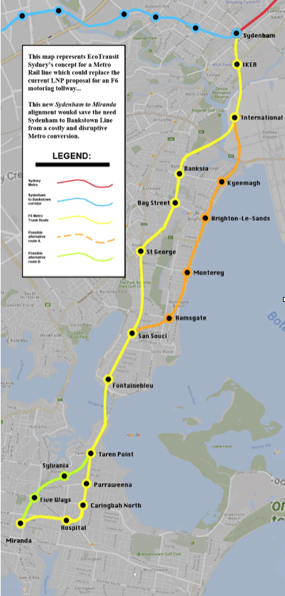
Route A
The Metro South platforms at Sydenham would necessarily be underground, leaving platforms 1 and 2 intact for Bankstown Line trains and train movements in and out of Meeks Road XPT Depot.
The Metro South would head in a southerly direction from Sydenham (in tunnels), under the Princes Highway to a station near Ikea, then continue under Alexandra Canal to a station at the International Airport. The line would have to cross the existing Airport Line by probably diving under it. This may involve some difficult engineering but would be simpler than building a six-lane tollway in tunnels.
From the International Airport, the Metro South would head under the Cooks River and under the M5 tollway, to the west of the M5 tunnel that takes the road under the river, until it reaches West Botany Street. Similar geotechnical difficulties could be encountered, similar to those faced during the construction of the Airport Line and the M5.
The Metro South would then follow the alignment of West Botany Street, with stations at Bestic Street and Bay Street. Before reaching President Avenue, the line would swing southwest, with a station at St George Hospital, near the intersection of Princes Highway and Rocky Point Road. This station would also serve St George TAFE, James Cook High and Moorefield Girls High.
The Metro South would then follow the alignment of Rocky Point Road, with stations at Ramsgate, Sans Souci and Fontainebleau Street. From here, the line could continue underground, under the Georges River and then follow the alignment of Taren Point Road. The alternative would be to surface and cross the river via a new bridge and continue along the F6 alignment before going back into tunnels at Holt Road.
There would be stations at Taren Point, Parraween Road and Caringbah North. After the station at North Caringbah, the Metro South would curve in a westerly direction to a point under the Kingsway, from it would follow the alignment of the Kingsway to Miranda. There would be a station at Sutherland Hospital. Prior to reaching Miranda, the line would curve to the south to the terminus under Miranda Fair. This also adjacent to the Cronulla Line where there would be an interchange.
Route B
This alternative route from the International Airport to Sans Souci would serve an area of higher population density as well as providing rail access to Botany Bay and the beaches at Brighton le Sands. There may be however, significant geotechnical difficulties in tunnelling through an area, which is predominantly sand.
From the Airport Station, the Metro South would head south, under the Cooks River, close to where it empties into Botany Bay. It would then follow the alignment of General Holmes Drive to a station at Kyeemagh. It would then continue under General Holmes Drive and then under The Grand Parade to Ramsgate, with stations at Brighton Le Sands and Monterey. Here the Metro South would curve in a south westerly direction passing under Ramsgate Road, where there would be a station, joining back with route A at Sans Souci.
Route C
This alternative route from Taren Point – Miranda would follow the F6 reserve as far as Port Hacking Road. It could be either a surface line or in tunnels. The Metro South would then follow the alignment of Port Hacking Road and Kiora Road to the terminus at Miranda. There would be stations at Taren Point, Sylvania Waters and The Five Ways.
The Sylvania Waters station would be located on the proposed F6 interchange, which would be a much better use of the site in terms of affecting the playing fields and nearby residents. There is space for a park and ride facility at this station.
What would be the cost?
The distance from Sydenham to Miranda is approximately 19 kilometres. This for Route A and would increase to approximately 20 kilometres, if Routes B and C are adopted.
The cost of the Epping to Chatswood Line was $220 million (converted to 2016 dollars) per kilometre. This gives a figure of $4.18 billion for Route A and $4.4billion when Routes B and C are taken into account. To these figures a further $1 billion contingency should be added to cover any unforeseen costs in tunnelling under or bridging over the Georges River.
Building the Metro South along this route would be significantly cheaper than tunnelling for the F6 along the same route and would probably be not much more than the conversion of the Bankstown Line to metro!
Commuter benefits
The currently T4 timetable has the fastest service from Miranda to Central taking 39 minutes and the slowest taking 54 minutes. With the proposed Metro South, EcoTransit estimate that all services (stopping at each station) would take 28 minutes from Miranda to Central. This would give time savings between 11 and 26 minutes.
EcoTransit would expect that this would change the travel patterns on the Cronulla Line, with commuters travelling from Cronulla, Woolooware, Caringbah, Gymea and Kirrawee to Miranda where they would interchange with the Metro for their commute to the CBD.
Map showing proposed route of the diverted metro in relation to the existing heavy rail lines.
Colin Schroeder
EcoTransit Sydney
contact@ecotransit.org.au
27-nov-2018